Resources
Tutorials
Remote Sensing & FireSat 101
FireSat Data Guide
Webinars on Demand
January 15, 2026
Western Fire Chiefs Association Fire Tech U
EFA’s Ann Kapusta and Sean Triplett joined this collaborative training hub for fire professionals to discuss how FireSat will integrate with existing tools to support a stronger common operating picture for near real-time situational awareness.
January 14, 2026
Portland State University
EFA’s Ann Kapusta presented to students and researchers as part of an ongoing series exploring wildfire risk in the Pacific Northwest. The discussion focused on Earth Fire Alliance’s mission and how FireSat is designed specifically to meet the needs of end users confronting a growing global wildfire crisis.
FireSat Data Visualization Gallery
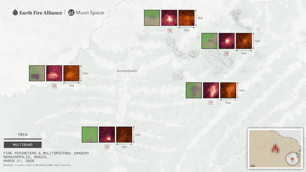
Rorainopolis, Brazil
FireSat detected a series of intentional fires smaller than 1×1 km–likely caused by agricultural or deforestation burns.
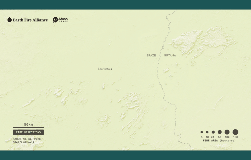
Brazil Multi-day Fire Detections
The FireSat protoflight detected dozens of fires of various sizes over the course of 5 days. Given the time of year and weather conditions these were likely intentional indigenous, agricultural, or deforestation burns.
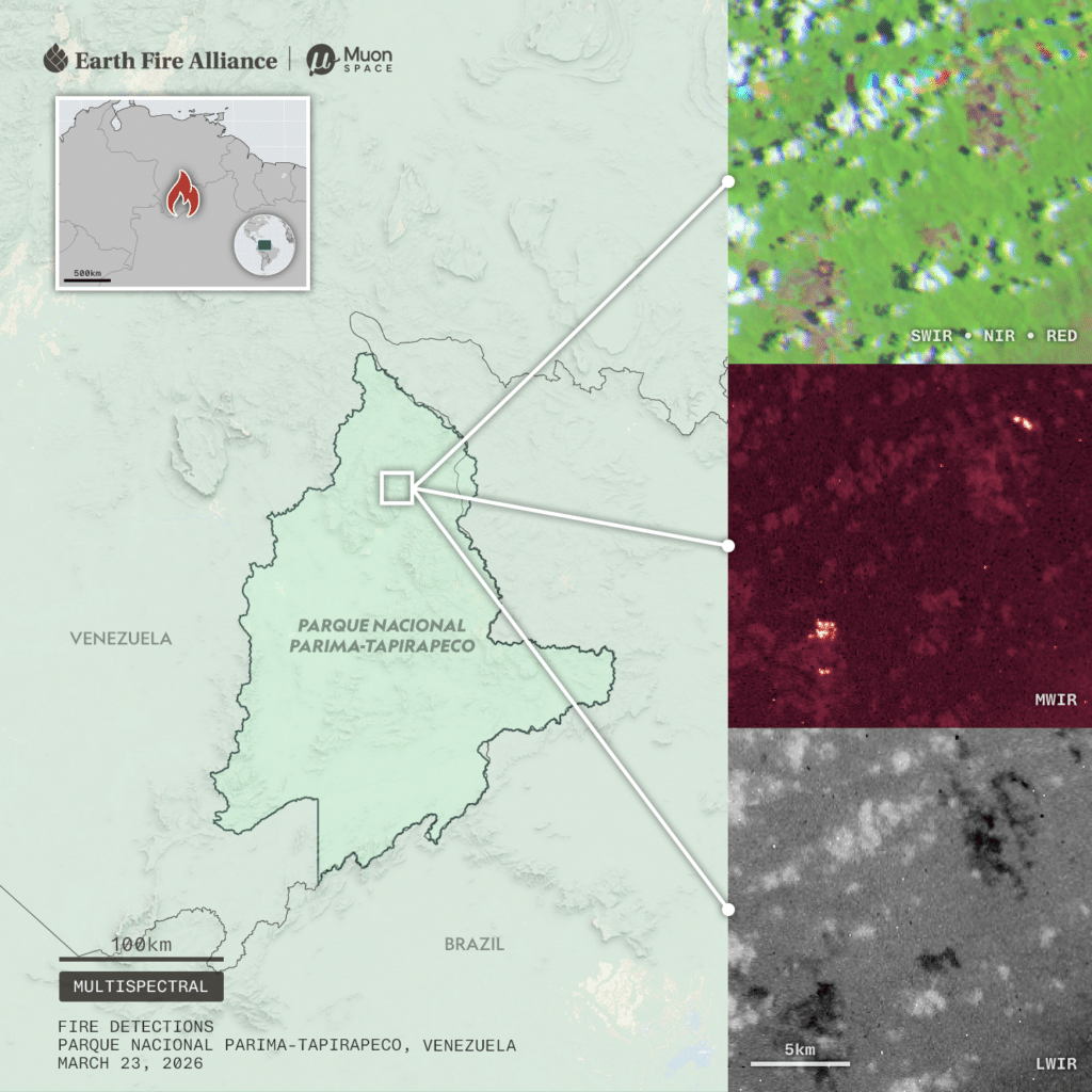
Venezuela National Park
A fire detection in Venezuela’ s Parque Nacional Parima-Tapirapeco. The SWIR/NIR/RED image at top right shows the high-level of cloud cover that day, which is common in tropical rainforests. The MWIR image at right middle demonstrates the FireSat sensor’s advanced ability to detect fires through cloudy conditions.
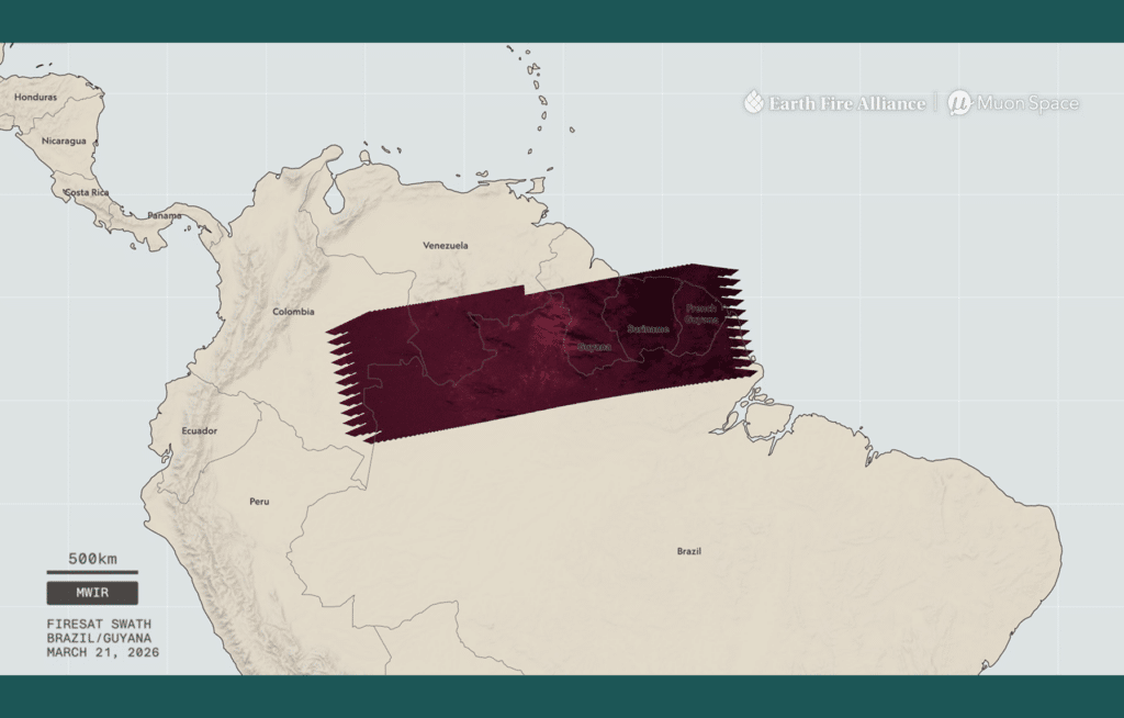
South America Swath
The FireSat protoflight captured data over northern South America. From the full 1,500 km swath spanning 6 nations to active fire detail along the Brazil/Guyana border in the midwave infrared band, this video demonstrates FireSat’s remarkable imaging capacity, which enables the satellite to monitor widespread fire activity across large landscapes.
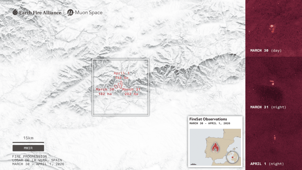
Losar de la Vera, Spain
FireSat monitored a fire’s progression over the course of three days.
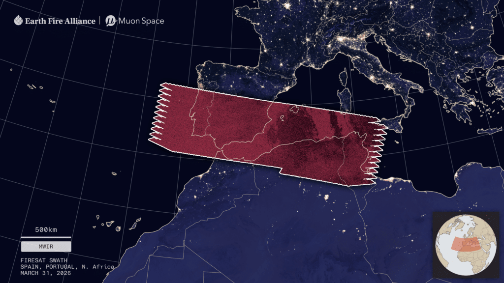
Iberian Peninsula Swath
The expansive 1,500 km FireSat swath visualized in midwave infrared (MWIR) over Spain, Portugal, and North Africa.
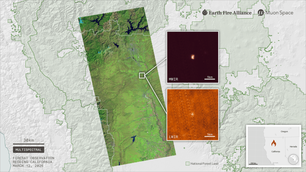
Shasta-Trinity National Forest, California, USA
This image demonstrates the sensor’s unprecedented ability to detect fires in their earliest stages. The inset fire details show a small fire detected in the mid- and long-wave infrared bands relative to a 2 km scale.
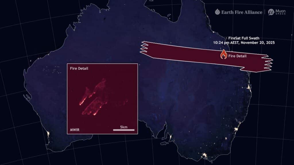
Australia Swath
Nighttime data capture over Queensland, Australia. From the full 1,500 km swath to active fire detail in the Midwave Infrared (MWIR) band, this video demonstrates the sensor’s remarkable imaging capacity, which enables FireSat to monitor widespread fire activity across large landscapes.
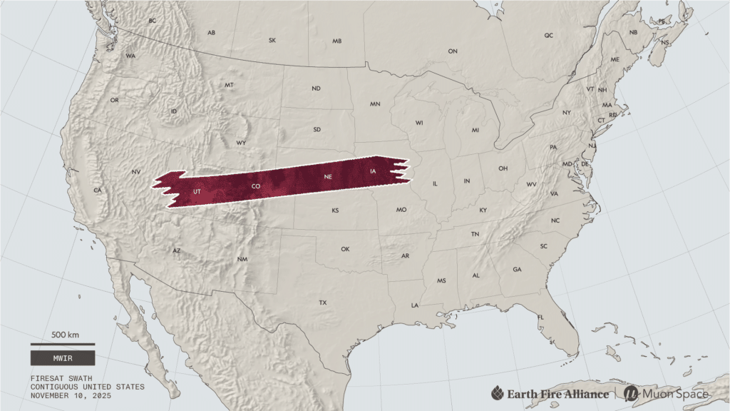
U.S. Swath
The expansive 1,500 km FireSat swath visualized in midwave infrared (MWIR) over the western contiguous United States.
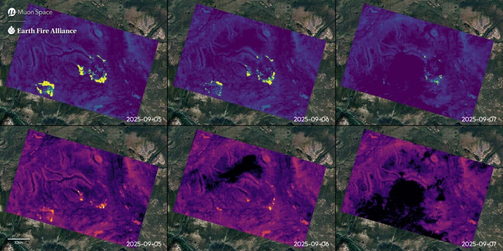
Beef Trail Creek Fire, British Columbia, Canada
This image compares Mid-Wave Infrared (MWIR) and Long-Wave Infrared (LWIR) channels across three consecutive nights. The MWIR channel (top row) identifies active wildfire areas in bright yellow, while the LWIR channel (bottom row) reveals thermal intensity from the fire front. Both channels show the fire’s progression and significant reduction in intensity by September 7. Cloud cover appears as dark patches in LWIR imagery, particularly on September 7. This multi-band, multi-day monitoring demonstrates how FireSat’s complementary infrared channels work together to provide comprehensive wildfire intelligence.
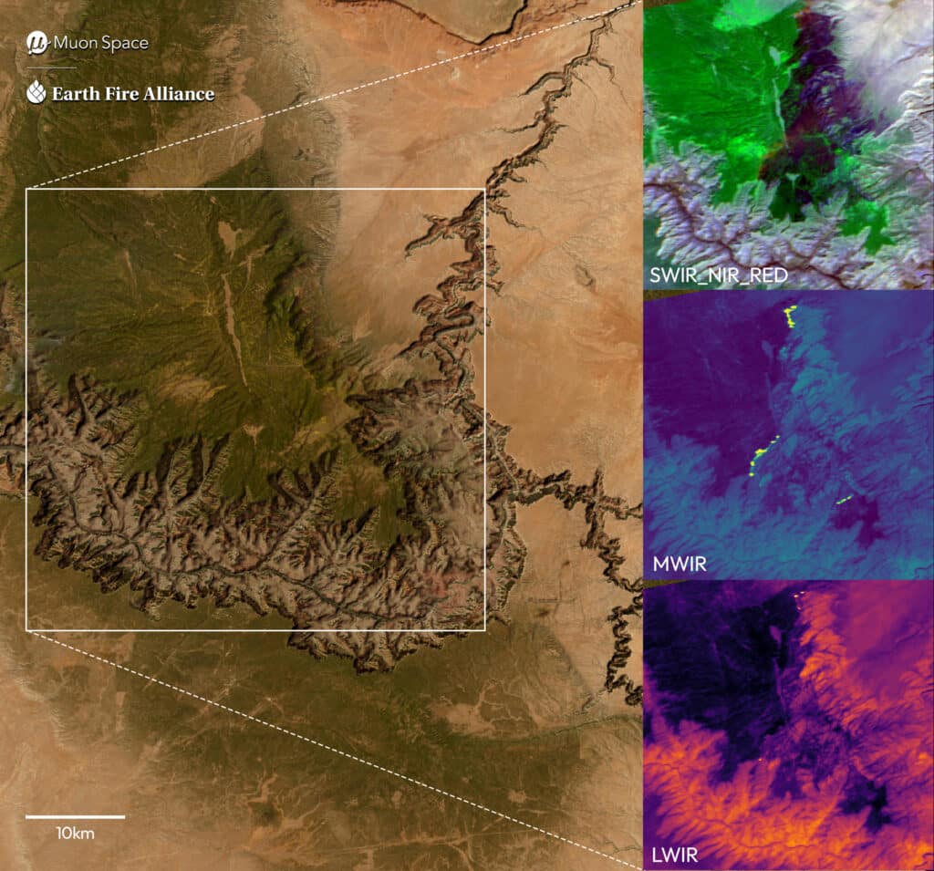
Dragon Bravo Fire, Arizona, USA
FireSat captured this multi-band view along the north rim of the Grand Canyon. In the SWIR_NIR_RED false-color composite at top right, the burned area stands out as dark purple in contrast with the surrounding vegetation in green. The Mid-Wave Infrared (MWIR) view isolates the actively burning fire front, visible in bright yellow. The Long-Wave Infrared (LWIR) image reveals the broader pattern of surface temperatures across the canyon. Together, these complementary perspectives illustrate how FireSat delivers complete wildfire intelligence—from active heat to recent burn footprint to remaining vegetation–in one integrated view.
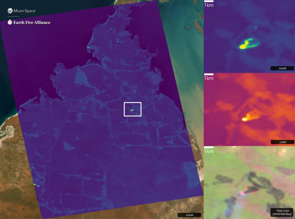
Dampier, Australia
This image captures several fires across the peninsula, demonstrating a broad-picture scope of concurrent fires. The Mid-Wave Infrared (MWIR) channel detects small, early-stage fires while the Long-Wave Infrared (LWIR) channel highlights a range of active fire temperatures. The image shows FireSat’s ability to identify fires early, monitor ongoing fire conditions, and show end users the full range of active fires in their region.
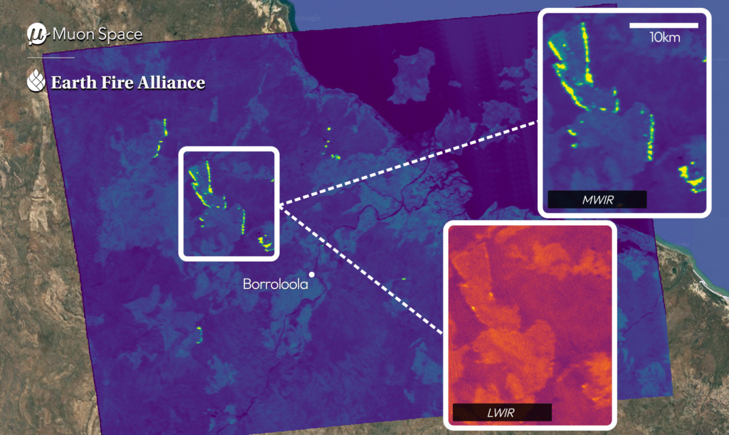
Borroloola, Australia
This image of multiple active fires demonstrates FireSat’s ability to monitor widespread fire activity across expansive landscapes. FireSat’s Mid-Wave Infrared (MWIR) channel identifies numerous distinct active fire areas and burning fire fronts scattered throughout the region. Both the MWIR and Long-Wave Infrared (LWIR) channels reveal variations in surface temperatures across the landscape, providing environmental context alongside precise fire detection. This multi-fire detection showcases FireSat’s ability to provide regional fire intelligence that enables coordinated response efforts across simultaneous wildfire events.
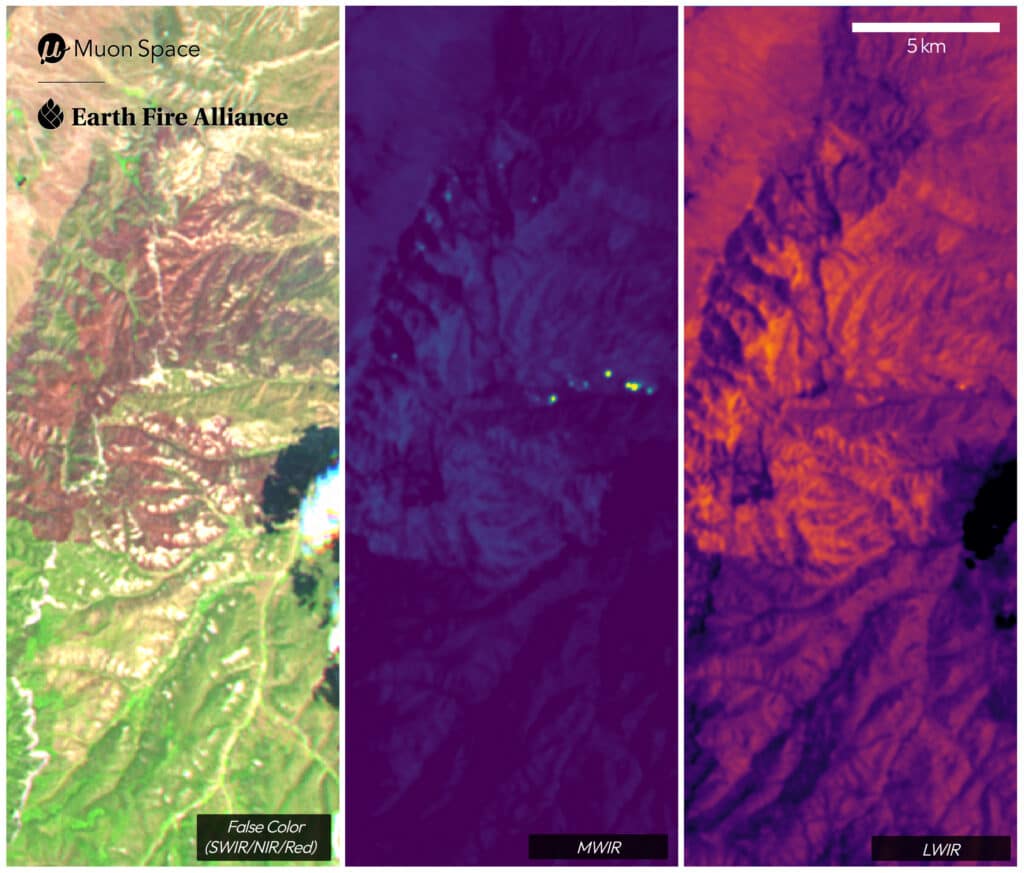
France Canyon, Utah, USA
FireSat’s Mid-Wave Infrared (MWIR) channel (middle) reveals the actively burning fire front, while the false-color composite (left) displays the recent burn area in distinctive rust and brown tones. The burn area had cooled sufficiently that it barely registered in the Long-Wave Infrared (LWIR) channel (right), highlighting FireSat’s ability to precisely track fire progression and distinguish actively burning areas from previously burned terrain.
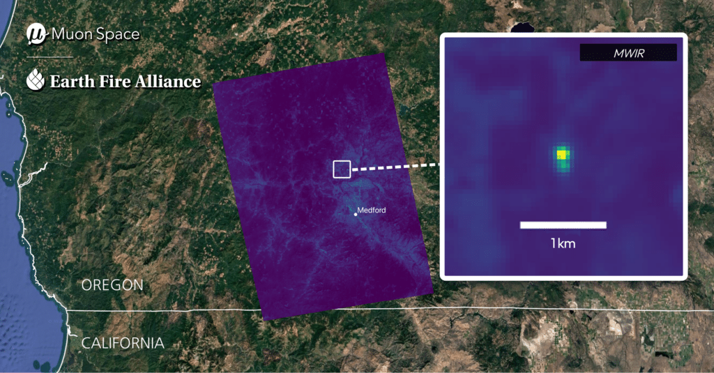
Small Roadside Fire, Oregon, USA
A small, relatively cool roadside fire that was not detected by other space-based systems. FireSat’s Mid-Wave Infrared (MWIR) channel provides a clear detection of this early-stage fire. This image demonstrates FireSat’s superior sensitivity and breakthrough capability to catch fires in their earliest stages before they grow into major threats.
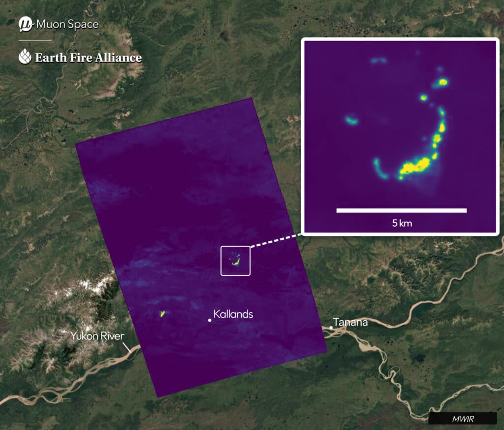
Moran and Chicken Fires, Alaska, USA
Two remote Alaskan wildfires captured in one image. FireSat’s Mid-Wave Infrared (MWIR) channel reveals both active fire fronts, demonstrating FireSat’s ability to simultaneously monitor multiple wildfire events. These detections provide critical near real-time insights on fire behavior in Alaska’s challenging and often inaccessible terrain, showcasing FireSat’s value for comprehensive wildfire monitoring in remote regions where ground-based observation can be difficult to achieve.
Nipigon 6 Fire, Ontario, Canada
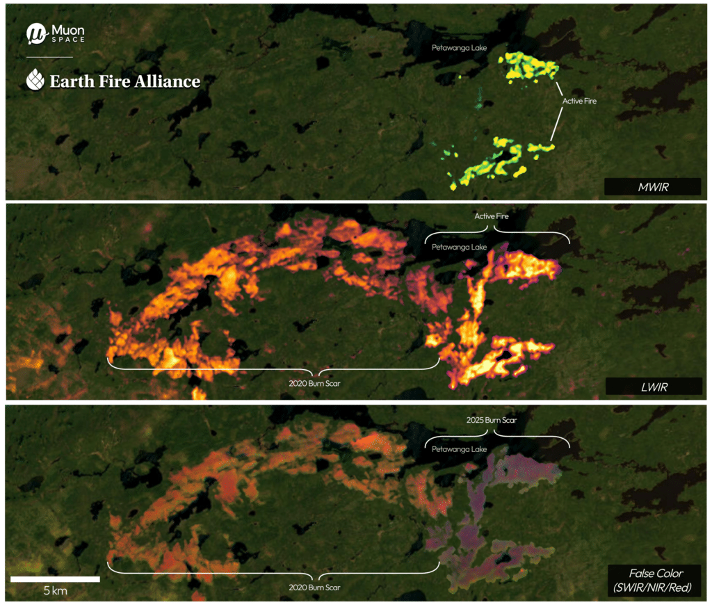
FireSat’s Mid-Wave Infrared (MWIR) channel (top) identifies active fire regions as bright spots. The Long-Wave Infrared (LWIR) channel (middle) highlights a range of heat sensing, including intense active flames to the east of Petawanga Lake and the burn area from a September 2020 fire being warmed by the sun west of the lake–burn areas are often warmer than surrounding areas due to a lack of vegetation. The false-color composite (bottom) using Short-Wave Infrared (SWIR), Near-Infrared (NIR), and visible Red channels reveals both burn areas–the one from 2020 in rust tones and the current fire in purple–demonstrating FireSat’s ability to provide comprehensive insights throughout a wildfire’s lifecycle.