
By Kristin Cody (Earth Fire Alliance) and Daniel Melling (CTrees)
During New York Climate Week in September, Earth Fire Alliance (EFA) and CTrees convened a workshop at the Doris Duke Foundation’s Treehouse around a pressing question: How can remote sensing technologies help manage severe wildfire risk in global forests?
While CTrees is building data systems to see every tree and associated fuel moisture on Earth, EFA is working to make every fire visible through its FireSat constellation. Together, these technologies have the potential to produce a living map of global forest risk, and a new ability to act on it. Subject matter experts from across the wildfire and forest conservation communities explored this premise and what it will take to realize it.
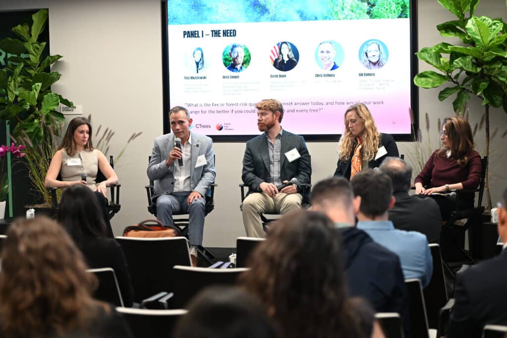
As forest fires intensify, better datasets are needed
Sassan Saatchi, CEO and Chief Scientist at CTrees, set the stakes. Last year, between 40 and 50 percent of global forest loss was caused by fire, and fire behavior continues to grow more severe as drought intensifies in many parts of the world.
Yet many equations used for fire modeling are decades old. FireSat’s observations of near real-time fire behavior will make it possible to develop new models for the climate and landscapes of today.
Building data for fire response and resilience
Panelists emphasized the need for operational data at multiple stages in the fire response cycle: to guide real-time decisionmaking as fires occur, to help prevent catastrophic fires, and to plan for long-term forest resilience.
In many remote regions, first responders often have to decide how to act in conditions with hundreds of simultaneous early ignitions.
Chris Anthony–founder and CEO of FireWERX, a former CAL FIRE Deputy Director, and an EFA board member–described what changes when a fire is detected soon after it starts.
“Understanding what the fire is from the point of ignition for a very small 5×5 meter fire allows firefighters to move from a fire suppression response strategy to actually a beneficial fire response strategy,” he said.
By pairing data on fire intensity, tree species, canopy structure, and weather conditions, responders can change decisions fundamentally — including allowing some fires to burn for the benefit of the local ecosystem.
In the Amazon basin, where cycles of severe droughts are making forests vulnerable to fire, prevention has become a priority.
Ane Alencar, Director of Science at Brazil-based IPAM–a FireSat Early Adopter in the Modeler cohort–drew an important distinction: “The data that we need for prevention is totally different from the data that we need for action.”
Better data is also needed to support long-term planning for forest resilience.
Greg Cooper, Director of Conservation Implementation at the Sustainable Forestry Initiative (SFI), shared the landowner’s perspective. SFI certification is applied to more than 350 million acres across the U.S. and Canada, and requires certified landowners to develop wildfire resilience strategies and restore their land after a wildfire.
“If we have more information about where every fire and every tree is, it can really help support those landowners as they’re making decisions for resilience actions,” Cooper said.
A data gap: How to track forest treatments across the U.S.
The panel also identified a gap that high-fidelity fire and tree data can close: No single spatial dataset is used to track forest treatments across the contiguous U.S. with consistent definitions. Consequently, agencies and landowners are considering how to thin and treat landscapes without a shared picture of what has already been done.
Making data operational for fire management in the U.S. and worldwide
Panelists were precise about the conditions that turn observation into action.
Evrim Bunn, Senior Advisor at the U.S. Wildland Fire Service, framed it operationally: trust follows speed. “If the data comes fast enough, people will trust it.”
The real work is in data delivery — last-mile connectivity, and integration into the systems responders already use.
As a former firefighter, Anthony of FireWERX emphasized that the right information needs to reach the right decision level without overwhelming the people acting on it. He also noted that the cultures of the technologist and the firefighter are genuinely different, which is why co-development is essential (This is a practice EFA enacted by involving more than 200 firefighters and fire scientists in helping to define the requirements for FireSat).
Gill Einhorn, who heads the World Economic Forum’s Forest Future Alliance, said that in addition to satellites and data, investment is needed in the “enabling environment” to ensure the right data reaches the right end users at the right time.
And Santiago García Lloré, Director of Forests Partnerships at the Environmental Defense Fund, said readiness to adopt new technology varies widely across governments, and building the capacity for adoption at scale is an important part of these efforts.
Delivering global data for local fire management
Dr. Mike Falkowski, EFA’s Chief Scientist, described how the Alliance is building new programs to ensure data isn’t just collected, but easily accessible and actionable.
EFA’s three programs aim to form a through line from space to communities on the ground. While FireSat generates the global dataset, FireConnect will activate communities, firefighters, land managers, and researchers to connect that data to local action and support beneficial fire. FireImpact will translate the FireSat dataset into scientific knowledge that informs fire management strategies.The three-program structure is a direct answer to what both panels described as necessary: Global data, local action, long-term change.
For CTrees, advanced sensors like FireSat will enable new, localized data for wildfire resilience, including better estimates of fuel and moisture levels in forests, and improved forecasts of how fires spread. CTrees’ data solutions will be able to translate FireSat’s near real-time fire information into tree-level monitoring for forest management and fire prevention.
What’s next
The workshop set out to show what’s possible when every tree and every fire becomes visible. The discussion produced a shared account from the people who carry wildfire risk of how deeper collaboration between CTrees and EFA can enable improved forest intelligence for preventing disaster-level wildfires, and the capacity building needed to turn data into action for resilient forests.